Pages

Friday, September 28, 2012

Dahlonega & Amicalola

I headed back up north today to hit the Dahlonega gold museum and then over to the Amicalola Falls state park.  For those of you who don't know it, the first gold strike in the U.S. of A. was right here in Dahlonega, Georgia.  I'd been in the area a few times but never to the museum and besides, it is an official 'stop' on the History Trail geochallenge.  Finding the clues and opening the cache got me another location card and I noticed that the partner card was the Picketts Mill Battlefield site.  So, I turned in my cards to the nice ranger lady and she gave me my very first prize:  a history challenge path tag.  Yippee! 

Here it is... my prize!  It's a small medallion thing which is actually quite pretty.  The pick and rifle on the front signify the two locations visited for this challenge.  On the back is a registration number that you can use to register the tag and then place it out in a cache to see where it moves to.  I ain't giving up my tag!

Then it was off to the Amicalola Falls State Park to search for another state cache.  I'd been to the park before with friends Bill and Jane.  This was the park that had so many steps to go down to the bottom of the falls that I walked.  The cache walk and find were pretty lame.  Nowhere near the falls and the path was paved.... sheesh.  It took me longer to put my boots on, get my stuff on, walk to the trailhead through the parking lot than it did to walk to and find the cache.  Oh well, at least it's another challenge cache found.  Just for the record, a couple of pictures near the falls... not near the cache.

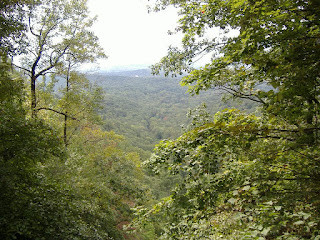
Taken right at the very top of the falls.  I'm standing on a little wooden bridge spanning the little creek that falls down the side of the mountain.  Very pretty view, for sure.

This was taken from the very same spot with the camera now pointed pretty much straight down.  This is the highest falls east of the Mississippi at 729 feet but it's a pretty lame waterfall as waterfalls go.  It's really more of a near-vertical rapids.  Regardless, it's pretty and this area of the park was, and I guess always is, quite crowed even on a weekday.

Looking back up at a part of the falls... maybe 200 feet of the fall.  I got this picture off Wikipedia.  They must have taken it in the winter months.  No leaves on the trees.  I have similar pictures at a previous posting on this blog:  http://bobcernock.blogspot.com/2011/08/long-overdue-visit.html


Wednesday, September 26, 2012

Chattahoochee Overland

The first visit to the Chattahoochee Bend State Park, Georgia's newest state park, had us playing in the playground and taking a walk along the river trail.  Yesterday I headed back there by myself with a list of hidden caches that were put out along a different trail.  I would end up at the river but I'd get there via an overland route, over hill and dale.  I had my list of cache coordinates and took off to see how many I could find.  Turns out it was my best day by far in terms of number of caches found... seven!  It was another beautiful day weather-wise and again going on a weekday I had this big, beautiful park all to myself.  Never saw another person aside from the ranger in the information center where I started out from.  I ended up being out a bit longer than I had anticipated -- took me a bit to find the caches once I was in the vicinity -- but it's not like I'm on a schedule.  Total trek was just over 6 miles over terrain that wasn't all that bad.  Of course there were ups and downs over the hills and such but nothing like the weekend adventures.

Caches 1 and 2.  The first one was right at the information center and was one of the most clever jobs of hiding I've encountered.  Talk about hiding something in plain sight!  It's a PVC pipe and screw on lid just like those around my own house and was located not far from a downspout.  It actually took me longer to discover this one than any of the others... go figure.  I walked past the 2nd one but found it when I turned around.  I covered it a bit better before I left.

Numbers 3 and 4.  I'm not real big on sticking my hand into holes in the ground or in a tree trunk or the like.  I use my walking stick to poke around for living things first.  I was a bit surprised that with the cool mornings and very warm afternoons we've been having I didn't see a single snake.  I would have thought they'd have been out sunning themselves to warm up.

Numbers 5, 6, and 7.  These were some pretty good hiding places but the gps unit was working pretty well and I was rather happy with myself that I found every one on my list.  After the last one I turned around and headed back.  Funny how the hills get steeper later in the day.

Monday, September 24, 2012

Sweetwater Solo

Well, it was my first time going out to a state park solo.  I needed to go to the park anyway to pick up a voucher to get my first 'award' from the state of Georgia for visiting 15 different state parks and finding the official cache at each of them.  I figured I'd go find another one in the park while I was there and it was a great walk in areas of the park I hadn't visited before.  The great thing about this state park is that it's less than 20 minutes away... yippee!  I did double check my gear and such not wanting to be unprepared should I encounter some unforeseen adventure, like getting a snake bite or falling down a cliff while out alone.  The cache was a multi-cache which means I was walking to various places to get clues needed to get into the cache.  I did all right, found all the clues needed to open the cache, and had a most lovely walk in the woods... without any of those unforeseen adventures :)
One part of the walk, about 3 miles in all, was along this very pretty creek.

Further along was the history lesson for the day, visiting the location of what was once a thriving manufacturing company.  Rather incredible to me that the chase for the waterwheel (the canal-like run dug out to divert water to the waterwheel) is still very noticeable.  I love seeing this historical stuff... imagining what once was and all.  If you click on the picture and make it bigger you can read about it which will provide background for the next photo.

This is what remains today, and was all that remained the day after those damn yankees came down here and burned the place in July of 1864.

Further along I found this narrower finger of the creek and was able to walk out into the middle of it to snap this picture looking one way...

...then turned around and snapped this picture looking the other way.

And this lovely view is of the place I sat for a while to rest a bit and eat a bit of lunch.  I really enjoyed this.  Sitting here with no one around and the only sound being that of the water running through these rocks.  Very nice indeed :)  It was a good little adventure and I'm glad I got out.  More solo trips to come I figure.

Sunday, September 23, 2012

Mountain Adventures

I headed out this weekend for northern GA to visit a couple of state parks up in the mountains.  It was a beautiful, bright day and the temperature wasn't too hot.  First stop was at Cloudland State Park and although I've got pictures below, you all know that pictures just don't capture the real view.
This is Cloudland Canyon.  This view/overlook was a very short walk from where I had parked and it was just so beautiful.  Not a cloud in the sky and bright sunshine.  I was hoping that the geocache wasn't at the bottom of this puppy.  Hopes in that regard were soon dashed :)

After a short walk along the rim of the canyon I got to the trail head and this lovely message appeared.  At this point I was already hearing rushing water and started down into the canyon.  The trails were pretty steep and there were a LOT of stairs to get down the areas where the canyon walls were just to steep for a trail.  There are 2 main waterfalls, marked as such, and although I did get near them I didn't take a single picture of either.  Go figure.  The trip down the canyon sides and along the bottom was just incredibly beautiful.  Lots of noisy, rushing water, rocks galore some of which were absolutely giagantic and one just had to wonder what it must have been like when they came down.  It was a long time ago for sure because the floor of the canyon is heavily forested.

Still going down but basically at the base of the canyon.

Looking down along the floor of the canyon as I crossed a bridge to the other side.

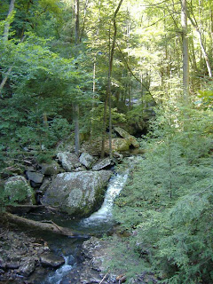
A fast, noisy waterfall that was not included in the two waterfalls to be seen.  This sucker was probably 40-50 feet high and again, just beautiful.

Just included this one because it's pretty :)

The geocache was located in the hollow base of the tree pretty much in the center of this photo.  Is this gorgeous or what?!?!?  Due to the terrain and the canyon playing a bit of havoc with the gps readings this find took quite a while.  I did NOT rush to leave the area as I was a bit tired and I knew what the return trip was going to be like.
 
After resting and cleaning up a bit I got back in the car and headed off to another state historical site for a pretty easy multi-cache where I learned a bit of history as well.  From there it was off to Fort Mountain State Park and yet another 'mountain' trek.  The trek for this one was much, much easier as we took a nice walk around a lake to find the fork in the trail to get to the cache.  The cache description was spot on... the last 2/10ths of a mile were severe, headed right up the mountain.  No meandering back and forth... straight up.  I got to the area, found the cache, and agin took a bit of a break.  Heading back was so much easier this time.  Downhill and level the whole way :)

Wednesday, September 5, 2012

Once A Bridge

After not really going out over the Labor Day weekend and it being rather rainy yesterday I got out today to another of the state parks here in Georgia to find the geocache there.  It was good to be out and about, for sure.  Panola Mountain State Park is primarily a conservation area with a lot of protected land and property but at the same time there are a lot of community things as well.  There is a two lane concrete bike path that goes for 18 miles... one way.  There's also a rather large maintained field for flying remote-controlled planes and a few lakes around which some folks were fishing.  A very nice park for sure.  The cache was an easy walk along a golf cart path along an abandoned golf course that must have been abandoned some time ago.  I walked beyond the cache site and found an old bridge that was on the 'things to see' list and I'm glad I got there.  This kind of stuff really gets my mind whirling imagining what was once but is no more.
So this is the bridge I found.  So many 'things' about it that I'd love to know about.  Those things that might look like fallen leaves, aren't.  Yeah, there's some leaves but there are hundreds of man-made depressions in what looks like some crummy concrete and why those depressions are there is just one of those things that baffled me.

As said in the title of the post, this was 'once' a bridge, but no more.  If you blow up this photo by clicking on it you can those depressions pretty clearly.  The closest thing that I know that they look like are bear claw scratches... 3 perpendicular lines about 4-5 inches long... hundreds of them in random directions.

As I just kind of stood around taking a bit of a break I kept discovering things.  You can see that this was a very well made structure.  A very solid flat rock base, cast iron/steel support pieces, and then the concrete layer, perhaps added when it was built, perhaps added later.  Another thing I'd like to know.

I took this picture because I was just kind of dreaming, I guess.  Like, what the hell happened here?!?!?  That's 4-5 feet of dirt settled on top of what once was an active bridge and an active road.  Beyond it, very dense growth that has obviously been there for a while.  It became more intriguing when I went back.  I didn't follow the cart path back but followed a road in the opposite direction to the photos here.  The road was an untraveled dirt/gravel road at least two cars wide.  A ways up this road I noticed a road sign in the brush/trees and when I went over to get to where I could read it, it said One Lane Bridge Ahead.  So, this was an active road and an active bridge at one time.  Now it's not.  Now I'm wishing there was a way I could have gotten across this somewhat deep little river/creek to see what was on the other side.  There was no informational sign or the like to be found so this will bug me for a while, I'm sure :)